
Datei:British Columbia-map.png
Diar as nian huuger apliasang diar.
British_Columbia-map.png (280 × 230 pixels, dateigrate: 14 KB, MIME-typ: image/png)

|
File:British Columbia, Canada.svg ist eine vektorisierte Version dieses Bildes. Diese sollte an Stelle des Rasterbildes verwendet werden, sofern sie nicht schlechter ist.
File:British Columbia-map.png → File:British Columbia, Canada.svg
Für weitere Informationen siehe Help:SVG. |
 |
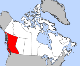
Map of British Columbia
Projection: Lambert azimuthal equal-area
Geospatial data from: The Atlas of Canada, The National Atlas of the United States archive copy at the Wayback Machine and U.S. Geological Survey
Cartographer: John Fowler
| Ik haa a rochten üüb detdiar datei an du det frei üs public domain (för arken frei). Det täält uun arke lun. Uun enkelt lunen mei det ei mögelk wees. Wan det so as: Arken koon detdiar werk brük för wat hi wal, wan det uun sin lun rochtelk mögelk as. |
Datei wersioonen
Klike üüb en tidjponkt, am detdiar wersion uuntulukin.
| Dootem/Tidj | Föörskaubil | Miaten | Brüker | Komentaar | |
|---|---|---|---|---|---|
| aktuel | 14:12, 24. Mar. 2005 | | 280 × 230 (14 KB) | Voyager | Map of British Columbia Projection: Lambert azimuthal equal-area Geospatial data from: [http://atlas.gc.ca/ The Atlas of Canada], [http://www.nationalatlas.gov/ The National Atlas of the United States] and [http://www.usgs.gov U.S. Geological Survey] C |
Hü det datei brükt woort
Nään artiikel brükt detheer datei
Globaal brük faan datein
Jodiar ööder Wikis brük detdiar datei:
- Brük üüb fr.wikipedia.org
- Brük üüb he.wikivoyage.org