
Datei:NASA Mando-Koresand.png
Grate faan detdiar föörskaubil: 612 × 599 pixel. Ööder apliasangen: 245 × 240 pixel | 620 × 607 pixel.
Originaal datei (620 × 607 pixels, dateigrate: 962 KB, MIME-typ: image/png)
Beskriiwang
| Beskriiwang |
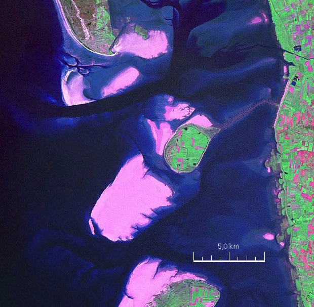
English: Mandø, the Danish Wadden Island, with Koresand close southwest, Fanø to the north, Romø to the south and the Jutland mainland coast to the east |
| Dootem | |
| Kwel | NASA World Wind Screen Shot |
| Skriiwer of Konstler | NASA |
Lisens
| Diese Datei ist gemeinfrei (Public Domain), da es sich um einen Screenshot der NASA-Software World Wind handelt, in der ein gemeinfreier Datensatz wie Blue Marble, MODIS, Landsat, SRTM, USGS oder GLOBE verwendet wird.
|
 |
| Annotations | This image is annotated: View the annotations at Commons |
Datei wersioonen
Klike üüb en tidjponkt, am detdiar wersion uuntulukin.
| Dootem/Tidj | Föörskaubil | Miaten | Brüker | Komentaar | |
|---|---|---|---|---|---|
| aktuel | 19:57, 19. Aug. 2009 | | 620 × 607 (962 KB) | Ratzer | {{Information |Description={{en|1=Mandø, the Danish Wadden Island, with Koresand close southwest, Fanø to the north, Romø to the south and the Jutland mainland coast to the east}} |Source=NASA World Wind Screen Shot |Author=NASA |Date=2000 |Permission= |
Hü det datei brükt woort
Detdiar sidj brükt detdiar datei:
Globaal brük faan datein
Jodiar ööder Wikis brük detdiar datei:
- Brük üüb da.wikipedia.org
- Brük üüb de.wikipedia.org
- Brük üüb fr.wikipedia.org
- Brük üüb fy.wikipedia.org
- Brük üüb hu.wikipedia.org
- Brük üüb no.wikipedia.org
- Brük üüb sv.wikipedia.org