
Datei:Bedfordshire UK locator map 2010.svg

Größe der PNG-Vorschau dieser SVG-Datei: 494 × 600 pixel. Ööder apliasangen: 198 × 240 pixel | 395 × 480 pixel | 633 × 768 pixel | 843 × 1.024 pixel | 1.687 × 2.048 pixel | 1.108 × 1.345 pixel.
Originaal datei (SVG-datei, grate: 1.108 × 1.345 pixel, dateigrate: 302 KB)
Beskriiwang
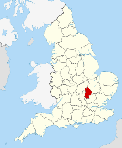
| Beskriiwang | Location of the ceremonial county of Bedfordshire within England. |
| Dootem | |
| Kwel |
National Geospatial-Intelligence Agency
|
| Skriiwer of Konstler | Nilfanion |
Lisens
Ik hual a rochten üüb detdiar werk, an du det frei oner a lisensen:
Detdiar datei häält en lisens oner det Creative-Commons-lisens „Nööm nääm - Oner salew konditjuunen 3.0. Ei portiaret“.
- Dü mutst detdiar werk
- widjer du – detdiar werk kopiare an widjer du
- nei tuupstel – det werk feranre
- Oner jodiar konditjuunen:
- Nööm nääm – Dü skel di nööm faan di skriiwer of konstler nääm. Oober ei so, dat at so ütjsjocht, üs wan hi din werk gud fanjt.
- Oner josalew konditjuunen widjerdu – Wan dü detdiar werk feranerst, skel dü det resultaat oner detsalew lisens widjer du.

|
Dü könst det datei kopiare, widjerdu of feranre efter a reegeln faan't GNU Free Documentation License, wersion 1.2 of leeder faan't Free Software Foundation; diar as niks ünferanerlik an nään tekst üüb a föör- of bääftsidj. Dü könst di lisens tekst efterlees bi GNU Free Documentation License. |
Schük di ian faan jodiar lisensen ütj.

|
Dies ist eines der Bilder, die Teil der Serie wertvoller Bilder sind: Locator maps of the Ceremonial counties of England auf Wikimedia Commons. Die Bilderserie wurde anhand der Kriterien für wertvolle Bilder bewertet und gilt als der wertvollsten Bildreihen auf Commons innerhalb des Geltungsbereichs:
Locator maps of the Ceremonial counties of England
Du kannst die Nominierung auf Commons:Valued image candidates/Locator maps of English ceremonial counties einsehen. |
Datei wersioonen
Klike üüb en tidjponkt, am detdiar wersion uuntulukin.
| Dootem/Tidj | Föörskaubil | Miaten | Brüker | Komentaar | |
|---|---|---|---|---|---|
| aktuel | 00:28, 24. Nof. 2010 | | 1.108 × 1.345 (302 KB) | Nilfanion | == Summary == {{Information |Description=Location of the ceremonial county of Bedfordshire within England. |Source=Ordnance Survey [https://www.ordnancesurvey.co.uk/opendatadownload/products.html OpenData]: *County |
Hü det datei brükt woort
Detdiar sidj brükt detdiar datei:
Globaal brük faan datein
Jodiar ööder Wikis brük detdiar datei:
- Brük üüb af.wikipedia.org
- Brük üüb an.wikipedia.org
- Brük üüb ast.wikipedia.org
- Brük üüb be-tarask.wikipedia.org
- Brük üüb be.wikipedia.org
- Brük üüb bg.wikipedia.org
- Brük üüb br.wikipedia.org
- Brük üüb ca.wikipedia.org
- Brük üüb ceb.wikipedia.org
- Brük üüb cs.wikipedia.org
- Brük üüb dag.wikipedia.org
- Brük üüb el.wikipedia.org
- Brük üüb en.wikipedia.org
- Bedfordshire
- National nature reserves in Bedfordshire
- Beeston, Bedfordshire
- Southcote, Bedfordshire
- Studham
- Old Warden
- Stagsden
- Clapham, Bedfordshire
- Haynes, Bedfordshire
- Forest of Marston Vale
- Kempston Hardwick
- Millbrook, Bedfordshire
- Ridgmont
- Flitton and Greenfield
- Biddenham
- Leighton–Linslade
- Bletsoe
- Pavenham
- Felmersham
- Carlton with Chellington
- River Flit
- Chalgrave
- Template:Bedfordshire-geo-stub
- Aspley Heath
- Bolnhurst and Keysoe
- Brogborough
- Knotting and Souldrop
- Dean and Shelton
- Hulcote and Salford
- Wyboston
- Tebworth
- Steppingley
- Pulloxhill
- Souldrop
- Campton and Chicksands
- Beadlow
- Bidwell, Bedfordshire
Muar globaal brük faan detdiar datei.