
Datei:Western Ghana districts.png
Grate faan detdiar föörskaubil: 776 × 600 pixel. Ööder apliasangen: 311 × 240 pixel | 621 × 480 pixel | 994 × 768 pixel | 1.056 × 816 pixel.
Originaal datei (1.056 × 816 pixels, dateigrate: 45 KB, MIME-typ: image/png)

|
Dieses Bild des Typs Locator map sollte als Vektorgrafik im SVG-Format neu erstellt werden. Vektorformate haben zahlreiche Vorteile; weitere Information unter Commons:Media for cleanup. Wenn dir eine SVG-Version dieses Bildes vorliegt, so lade diese bitte hoch. Nach dem Hochladen der Datei ist diese Vorlage auf der aktuellen Bildbeschreibungsseite durch die Vorlage {{Vector version available}}, oder kürzer {{Vva}}, zu ersetzen. Es ist empfohlen die neue SVG-Datei „Western Ghana districts.svg“ zu nennen – dann benötigt die Vorlage vector version available (bzw. vva) keinen Parameter.
|
Beskriiwang
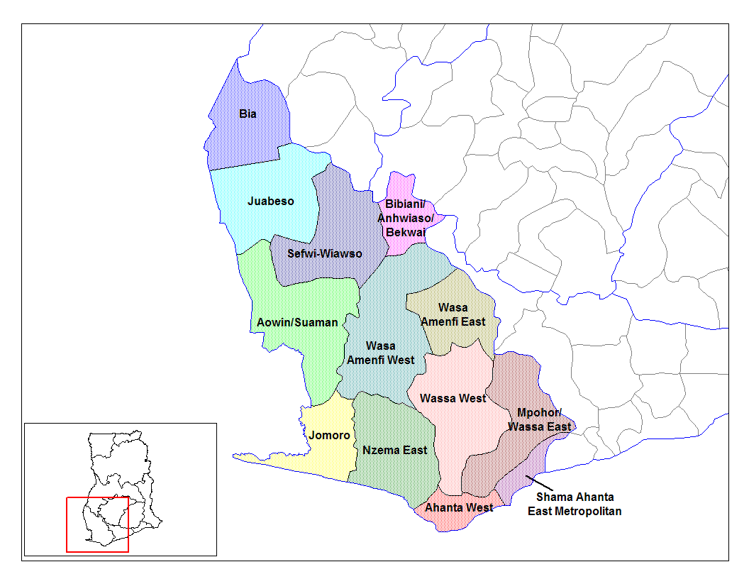
from en:districts of ghana Map of the districts of the Western region of Ghana. Created by Rarelibra for public domain use. Created using MapInfo Professional v7.5 and various mapping resources.
I, the creator of this work, hereby release it into the public domain. This applies worldwide. In case this is not legally possible, I grant any entity the right to use this work for any purpose, without any conditions, unless such conditions are required by law.
* (del) (cur) 08:09, 5 March 2006 . . Rarelibra (Talk | contribs) . . 1056x816 (45,897 bytes) (Map of the districts of the Western region of Ghana. Created by Rarelibra for public domain use. Created using MapInfo Professional v7.5 and various mapping resources.)
Created by Rarelibra for public domain use
Lisens
| Ik haa a rochten üüb detdiar datei an du det frei üs public domain (för arken frei). Det täält uun arke lun. Uun enkelt lunen mei det ei mögelk wees. Wan det so as: Arken koon detdiar werk brük för wat hi wal, wan det uun sin lun rochtelk mögelk as. |
Datei wersioonen
Klike üüb en tidjponkt, am detdiar wersion uuntulukin.
| Dootem/Tidj | Föörskaubil | Miaten | Brüker | Komentaar | |
|---|---|---|---|---|---|
| aktuel | 16:04, 28. Jun. 2006 | | 1.056 × 816 (45 KB) | Ahanta | from en:districts of ghana Map of the districts of the Western region of Ghana. Created by Rarelibra for public domain use. Created using MapInfo Professional v7.5 and various mapping resources. I, the creator of this work, hereby release it into the pub |
Hü det datei brükt woort
Detdiar sidj brükt detdiar datei:
Globaal brük faan datein
Jodiar ööder Wikis brük detdiar datei:
- Brük üüb ca.wikipedia.org
- Brük üüb ceb.wikipedia.org
- Brük üüb dag.wikipedia.org
- Brük üüb de.wikipedia.org
- Brük üüb en.wikipedia.org
- Aowin/Suaman District
- Shama Ahanta East Metropolitan District
- Wassa West District
- User talk:Rarelibra/Maps2
- List of hospitals in Ghana
- Bia District
- List of Ghana Parliament constituencies
- User:GerardM/Districts of Ghana
- Mpohor/Wassa East District
- Wassa Amenfi District
- Juaboso-Bodi District
- Juaboso-Bia District
- Nzema District
- Sekondi Takoradi Metropolitan Authority
- Wassa-Fiase-Mpohor District
- Aowin-Amenfi District
- Sefwi-Bibiani District
- Brük üüb eo.wikipedia.org
- Brük üüb es.wikipedia.org
- Brük üüb fa.wikipedia.org
- Brük üüb fr.wikipedia.org
- Brük üüb gpe.wikipedia.org
- Brük üüb ha.wikipedia.org
- Brük üüb it.wikipedia.org
- Brük üüb ja.wikipedia.org
- Brük üüb ko.wikipedia.org
- Brük üüb la.wikipedia.org
- Brük üüb nl.wikipedia.org
- Brük üüb pl.wikipedia.org
Muar globaal brük faan detdiar datei.