
Datei:Ancient Egypt map-de.svg

Größe der PNG-Vorschau dieser SVG-Datei: 293 × 598 pixel. Ööder apliasangen: 117 × 240 pixel | 235 × 480 pixel | 376 × 768 pixel | 501 × 1.024 pixel | 1.003 × 2.048 pixel | 1.577 × 3.219 pixel.
Originaal datei (SVG-datei, grate: 1.577 × 3.219 pixel, dateigrate: 413 KB)
Beskriiwang
| Beskriiwang |
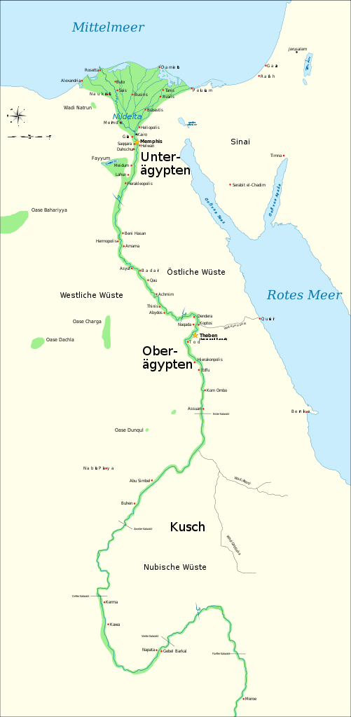
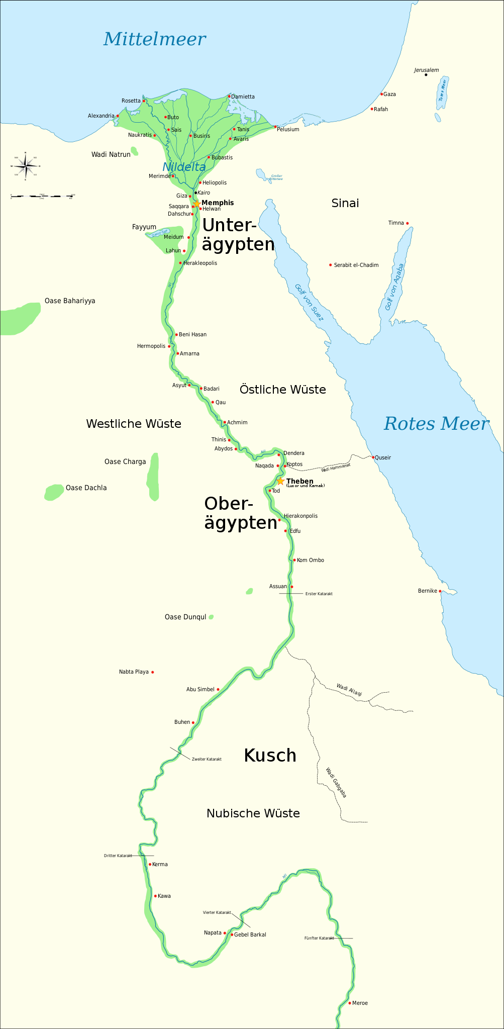
Deutsch: Karte des Alten Ägypten, zeigt den Nil bis zum Fünften Katarakt und die wichtigsten Städte der dynastischen Zeit (ca. 3150 v.Chr. bis 30 n.Chr.). Kairo and Jerusalem sind als Referenzstädte eingezeichnt. |
||
| Dootem | 6. Janewoore 2011, 12:56 (UTC) | ||
| Kwel | German translation of Ancient Egypt map-en.svg | ||
| Skriiwer of Konstler | |||
| Ööder wersioonen |
[]
|
||
| SVG‑Erstellung | Der Quelltext dieser SVG-Datei ist W3C-invalid wegen eines Fehlers.
|


Lisens
Ik hual a rochten üüb detdiar werk, an du det frei oner a lisensen:
Diese Datei ist unter den Creative-Commons-Lizenzen „Namensnennung – Weitergabe unter gleichen Bedingungen 3.0 nicht portiert“, „2.5 generisch“, „2.0 generisch“ und „1.0 generisch“ lizenziert.
- Dü mutst detdiar werk
- widjer du – detdiar werk kopiare an widjer du
- nei tuupstel – det werk feranre
- Oner jodiar konditjuunen:
- Nööm nääm – Dü skel di nööm faan di skriiwer of konstler nääm. Oober ei so, dat at so ütjsjocht, üs wan hi din werk gud fanjt.
- Oner josalew konditjuunen widjerdu – Wan dü detdiar werk feranerst, skel dü det resultaat oner detsalew lisens widjer du.

|
Dü könst det datei kopiare, widjerdu of feranre efter a reegeln faan't GNU Free Documentation License, wersion 1.2 of leeder faan't Free Software Foundation; diar as niks ünferanerlik an nään tekst üüb a föör- of bääftsidj. Dü könst di lisens tekst efterlees bi GNU Free Documentation License. |
Schük di ian faan jodiar lisensen ütj.
Originaal datei-logbuk
This image is a derivative work of the following images:
- File:Ancient_Egypt_map-en.svg licensed with Cc-by-sa-3.0,2.5,2.0,1.0, GFDL
- 2009-02-20T11:28:29Z Bibi Saint-Pol 1577x3219 (422457 Bytes) fix translation mistake on the windrose
- 2009-01-30T12:13:53Z Bibi Saint-Pol 1577x3219 (422444 Bytes) fix position of Nile Delta
- 2009-01-29T12:21:11Z Bibi Saint-Pol 1577x3219 (422383 Bytes) remove wrong text, adjust frame
- 2009-01-29T12:05:11Z Bibi Saint-Pol 1577x3219 (422757 Bytes) {{Assessments|1=Ancient Egypt map.svg|enwiki=1}} __NOTOC__ == {{int:filedesc}} == {{Information |Description= {{en|Map of Ancient Egypt, showing the Nile up to the fifth cataract, and major cities and sites of th
Hochgeladen mit derivativeFX
Datei wersioonen
Klike üüb en tidjponkt, am detdiar wersion uuntulukin.
| Dootem/Tidj | Föörskaubil | Miaten | Brüker | Komentaar | |
|---|---|---|---|---|---|
| aktuel | 14:57, 6. Jan. 2011 | | 1.577 × 3.219 (413 KB) | Festlesen~commonswiki | {{Information |Description={{de|Karte des Alten Ägypten, zeigt den Nil bis zum Fünften Katarakt und die wichtigsten Städte der dynastischen Zeit (ca. 3150 v.Chr. bis 30 n.Chr.). Kairo and Jerusalem sind als Referenzstädte eingezeichnt.}} |Source=*[[:F |
Hü det datei brükt woort
Detdiar sidj brükt detdiar datei:
Globaal brük faan datein
Jodiar ööder Wikis brük detdiar datei:
- Brük üüb als.wikipedia.org
- Brük üüb de.wikipedia.org