
Datei:Isle of Man location map.svg

Größe der PNG-Vorschau dieser SVG-Datei: 654 × 600 pixel. Ööder apliasangen: 262 × 240 pixel | 524 × 480 pixel | 838 × 768 pixel | 1.117 × 1.024 pixel | 2.234 × 2.048 pixel | 1.200 × 1.100 pixel.
Originaal datei (SVG-datei, grate: 1.200 × 1.100 pixel, dateigrate: 93 KB)
| Beskriiwang |
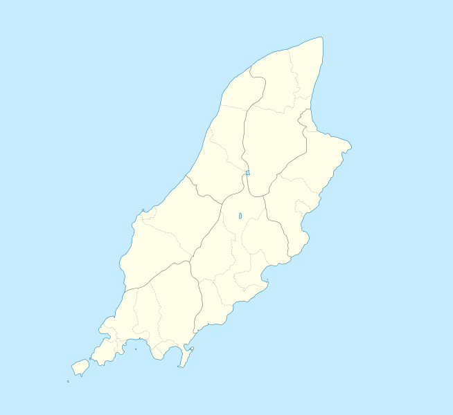
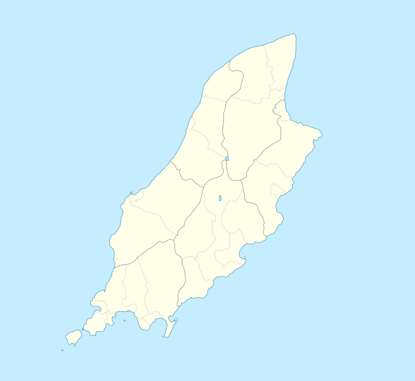
English: Location map of the Isle of Man, showing sheadings as well as local authorities (towns, villages, districts, parishes).
Geographic limits of the map:
|
| Dootem | |
| Kwel | |
| Skriiwer of Konstler |
|
Ik hual a rochten üüb detdiar werk, an du det frei oner a lisensen:
Diese Datei ist unter den Creative-Commons-Lizenzen „Namensnennung – Weitergabe unter gleichen Bedingungen 2.5 generisch“, „2.0 generisch“ und „1.0 generisch“ lizenziert.
- Dü mutst detdiar werk
- widjer du – detdiar werk kopiare an widjer du
- nei tuupstel – det werk feranre
- Oner jodiar konditjuunen:
- Nööm nääm – Dü skel di nööm faan di skriiwer of konstler nääm. Oober ei so, dat at so ütjsjocht, üs wan hi din werk gud fanjt.
- Oner josalew konditjuunen widjerdu – Wan dü detdiar werk feranerst, skel dü det resultaat oner detsalew lisens widjer du.
| Detdiar datei häält en lisens oner det Creative-Commons-lisens „Nööm nääm - Oner salew konditjuunen 3.0. Ei portiaret“. | ||
| ||
| Detdiar lisenstiaken kaam mä't GFDL lisens update. |

|
Dü könst det datei kopiare, widjerdu of feranre efter a reegeln faan't GNU Free Documentation License, wersion 1.2 of leeder faan't Free Software Foundation; diar as niks ünferanerlik an nään tekst üüb a föör- of bääftsidj. Dü könst di lisens tekst efterlees bi GNU Free Documentation License. |
Schük di ian faan jodiar lisensen ütj.
Originaal datei-logbuk
This image is a derivative work of the following images:
- File:IsleOfMan_SheadingsAndParishes-en.svg licensed with Cc-by-sa-2.5,2.0,1.0, Cc-by-sa-3.0-migrated, GFDL
- 2008-01-17T12:48:28Z Sémhur 1200x1100 (227618 Bytes) Update
- 2007-05-29T20:36:04Z Sémhur 1200x1100 (364350 Bytes) {{Information |Description=Map in english of the [[:en:Isle of Man|Isle of Man]], with bounds of sheadings, towns, villages, districts and parishes. |Source=Own work. Based on maps [[:Image:Isle of Man map-fr.svg]], [[:Image:
Hochgeladen mit derivativeFX
Datei wersioonen
Klike üüb en tidjponkt, am detdiar wersion uuntulukin.
| Dootem/Tidj | Föörskaubil | Miaten | Brüker | Komentaar | |
|---|---|---|---|---|---|
| aktuel | 01:00, 25. Sep. 2009 | | 1.200 × 1.100 (93 KB) | Entlinkt | {{Information |Description={{en|1=Location map of the Isle of Man, showing sheadings as well as local authorities (towns, villages, districts, parishes). Geographic limits of the map: * W: -4° 58' 0" * E: -4° 7' 0" * S: 54° 0' 0" * N: 54° 27' 30"}} |
Hü det datei brükt woort
Jodiar 11 sidjen brük detdiar datei:
Globaal brük faan datein
Jodiar ööder Wikis brük detdiar datei:
- Brük üüb af.wikipedia.org
- Brük üüb ar.wikipedia.org
- Brük üüb ast.wikipedia.org
- Brük üüb azb.wikipedia.org
- Brük üüb ba.wikipedia.org
- Brük üüb be.wikipedia.org
- Brük üüb bg.wikipedia.org
- Brük üüb bn.wikipedia.org
- Brük üüb br.wikipedia.org
- Brük üüb ceb.wikipedia.org
- Plantilya:Location map Isle of Man
- German
- Patrick
- Bride
- Andreas
- Douglas
- Saint Michaels Island
- Port Douglas
- Peel
- Isle of Man (pagklaro)
- Douglas Bay
- Isle of Man
- Santon
- Clay Head
- Craig Rock
- Ramsey Bay
- Rue Point
- Ramsey
- River Glass
- Chicken Rock
- Castletown
- Calf Sound
- Point of Ayre
- Crosby
- Little Ness
- Laksaa
- Snaefell
Muar globaal brük faan detdiar datei.