
Datei:Saitama-ken géolocalisation relief.svg

Größe der PNG-Vorschau dieser SVG-Datei: 800 × 512 pixel. Ööder apliasangen: 320 × 205 pixel | 640 × 410 pixel | 1.024 × 656 pixel | 1.280 × 819 pixel | 2.560 × 1.639 pixel | 1.715 × 1.098 pixel.
Originaal datei (SVG-datei, grate: 1.715 × 1.098 pixel, dateigrate: 1,84 MB)
Beskriiwang
| Kameraposition | | Dieses und weitere Bilder auf OpenStreetMap |
|---|
| Beskriiwang |
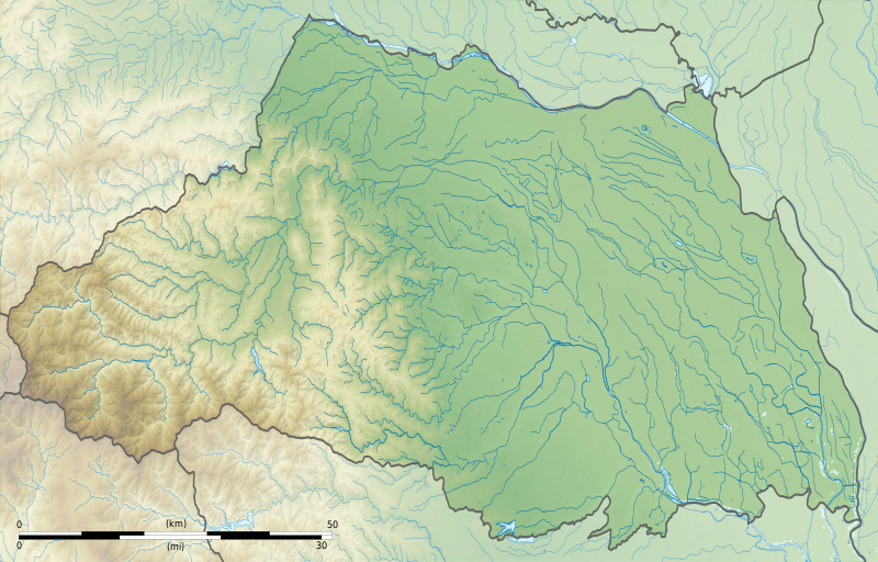
Français : Carte topographique vierge de la Préfecture de Saitama, au Japon, destinée à la géolocalisation.
Deutsch: Topographische Karte der Präfektur Saitama.
English: Topographic blank map of theSaitama Prefecture, for geolocalisation purpose.
Español: Mapa topográfico de la Prefectura de Saitama.
Italiano: Mappa topografica della Prefettura di Saitama.
日本語: 埼玉県の地図.
Português: Carta topográfica de la província de Saitama.
|
||
| Dootem | (UTC) | ||
| Kwel |
Création personnelle ;
|
||
| Skriiwer of Konstler | © Bourrichon (talk) - fr:Bourrichon | ||
| Ferloof (Hü det datei brükt woort) |
|
||
| Ööder wersioonen | File:Saitama-ken géolocalisation.svg |

|
This SVG file contains embedded text that can be translated into your language, using any capable SVG editor, text editor or the SVG Translate tool. For more information see: About translating SVG files. |
Diese W3C-unbestimmte Vektorgrafik wurde mit Inkscape erstellt .
Lisens
Ik hual a rochten üüb detdiar werk, an du det frei oner det lisens:
Diese Datei ist unter der Creative-Commons-Lizenz „Namensnennung – Weitergabe unter gleichen Bedingungen 2.0 Frankreich“ lizenziert.
nööm nääm: Bourrichon (atelier graphique)
- Dü mutst detdiar werk
- widjer du – detdiar werk kopiare an widjer du
- nei tuupstel – det werk feranre
- Oner jodiar konditjuunen:
- Nööm nääm – Dü skel di nööm faan di skriiwer of konstler nääm. Oober ei so, dat at so ütjsjocht, üs wan hi din werk gud fanjt.
- Oner josalew konditjuunen widjerdu – Wan dü detdiar werk feranerst, skel dü det resultaat oner detsalew lisens widjer du.

Datei wersioonen
Klike üüb en tidjponkt, am detdiar wersion uuntulukin.
| Dootem/Tidj | Föörskaubil | Miaten | Brüker | Komentaar | |
|---|---|---|---|---|---|
| aktuel | 20:49, 3. Jul. 2013 | | 1.715 × 1.098 (1,84 MB) | Bourrichon | == {{int:filedesc}} == {{Location|36|50|00|N|139|00|00|E|scale:10000}} {{Information |Description= {{fr|Carte topographique vierge de la préfecture métropolitaine de Tokyo (東京都, ''Tōkyō-to''), au [[:fr:Japon|Japon... |
Hü det datei brükt woort
Detdiar sidj brükt detdiar datei:
Globaal brük faan datein
Jodiar ööder Wikis brük detdiar datei:
- Brük üüb ar.wikipedia.org
- Brük üüb ceb.wikipedia.org
- Brük üüb ce.wikipedia.org
- Brük üüb de.wikipedia.org
- Brük üüb en.wikipedia.org
- Saitama Prefecture
- Hikawa Shrine (Saitama)
- Siege of Musashi-Matsuyama (1563)
- Kawagoe Castle
- Kumagaya Athletic Stadium
- Hachigata Castle
- Inariyama Kofun
- Minuma Tsūsen-bori
- Taki-no Castle
- Module:Location map/data/Japan Saitama Prefecture/doc
- Oshi Castle
- Iwatsuki Castle
- Handa Cup Senior Masters
- 1957 Canada Cup
- Koma Shrine
- Module:Location map/data/Japan Saitama Prefecture
- User:Ty654/List of earthquakes from 1920-1929 exceeding magnitude 6+
- User:Ty654/List of earthquakes from 1930-1939 exceeding magnitude 6+
- User:Ty654/List of earthquakes from 1965-1969 exceeding magnitude 6+
- Sugaya Yakata
- Sugiyama Castle
- Omishinkanji Kofun
- Miyazuka Kofun
- Mizuko Shell Mound
- Kurohama shell mound
- Shinpukuji shell mound
- Kawagoekan
- Gobōyama Site
- Tochimoto Barrier
- Nogamishimogō Stele
- Shinmei Shell Mound
- Minamikawara Stele
- Komae Village Stone Age Dwelling Site
- Shimozato-Aoyama Stele Production Site
- Suedono Tile Kiln
- Ōya Tile Kiln
- Hara kanga ruins
- Matsuyama Castle (Ranzan)
- Maruhakayama Kofun
- Teppōyama Kofun
- Kawarazuka Kofun
Muar globaal brük faan detdiar datei.