
Datei:Aisne department location map.svg

Größe der PNG-Vorschau dieser SVG-Datei: 404 × 599 pixel. Ööder apliasangen: 162 × 240 pixel | 323 × 480 pixel | 518 × 768 pixel | 690 × 1.024 pixel | 1.381 × 2.048 pixel | 1.124 × 1.667 pixel.
Originaal datei (SVG-datei, grate: 1.124 × 1.667 pixel, dateigrate: 399 KB)
Beskriiwang
| Kameraposition | | Dieses und weitere Bilder auf OpenStreetMap |
|---|
| Beskriiwang |
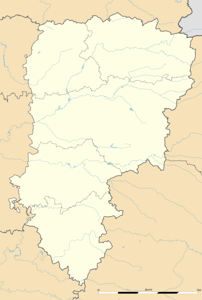
English: Blank administrative map of the department of Aisne, France, as in January 2015, for geo-location purpose, with distinct boundaries for regions, departments and arrondissements.
Français : Carte administrative vierge du département de l'Aisne, France, tel qu'en janvier 2015, destinée à la géolocalisation, avec limite distincte des régions, départements et arrondissements. Estimated scale: 1:360,000 (precision: 90 m)
Geographic limits of the map:
|
||
| Dootem | |||
| Kwel |
Aanj werk
|
||
| Skriiwer of Konstler | Eric Gaba (Sting - fr:Sting) | ||
| Ferloof (Hü det datei brükt woort) |
|
||
| Ööder wersioonen |
|

Lisens
Eric Gaba, Wikimedia Commons user Sting häält a rochten üüb detdiar werk an dää det frei oner det lisens:
Detdiar datei häält en lisens oner det Creative-Commons-lisens „Nööm nääm - Oner salew konditjuunen 3.0. Ei portiaret“.
nööm nääm: Eric Gaba, Wikimedia Commons user Sting
- Dü mutst detdiar werk
- widjer du – detdiar werk kopiare an widjer du
- nei tuupstel – det werk feranre
- Oner jodiar konditjuunen:
- Nööm nääm – Dü skel di nööm faan di skriiwer of konstler nääm. Oober ei so, dat at so ütjsjocht, üs wan hi din werk gud fanjt.
- Oner josalew konditjuunen widjerdu – Wan dü detdiar werk feranerst, skel dü det resultaat oner detsalew lisens widjer du.
Datei wersioonen
Klike üüb en tidjponkt, am detdiar wersion uuntulukin.
| Dootem/Tidj | Föörskaubil | Miaten | Brüker | Komentaar | |
|---|---|---|---|---|---|
| aktuel | 19:05, 12. Jan. 2015 | | 1.124 × 1.667 (399 KB) | Sting | == {{int:filedesc}} == {{Location|49|27|00|N|03|36|00|E|scale:500000}} {{Information |Description={{en|Blank administrative map of the department of Aisne, France, as in January 2015, for geo-location purpose, with distinct boundaries for... |
Hü det datei brükt woort
Detdiar sidj brükt detdiar datei:
Globaal brük faan datein
Jodiar ööder Wikis brük detdiar datei:
- Brük üüb als.wikipedia.org
- Brük üüb de.wikipedia.org
- Brük üüb en.wikipedia.org
- Brük üüb eo.wikipedia.org
- Villers-Cotterêts
- Vermand
- Château-Thierry
- Laon
- Saint-Quentin (Aisne)
- Soissons
- Vervins
- Beaurevoir
- Marly-Gomont
- Chézy-sur-Marne
- La Ferté-Milon
- Nogent-l'Artaud
- Charly-sur-Marne
- Bazoches-sur-Vesles
- Tergnier
- Ŝablono:Situo sur mapo Francio Aisne
- Saint-Quentin (stacidomo)
- Quierzy
- Laon (stacidomo)
- Soissons (stacidomo)
- Hirson (stacidomo)
- Hirson
- Vervins (stacidomo)
- Villers-Cotterêts (stacidomo)
- Longpont (stacidomo)
- Longpont
- Hirson-Écoles (stacidomo)
- Vierzy (stacidomo)
- Vierzy
- Versigny (stacidomo)
- Versigny (Aisne)
- Vaumoise (stacidomo)
- Coyolles
- Vauxaillon (stacidomo)
- Vauxaillon
- Verneuil-sur-Serre (stacidomo)
- Verneuil-sur-Serre
- Viry-Noureuil (stacidomo)
- Viry-Noureuil
- Fère-en-Tardenois (stacidomo)
- Fère-en-Tardenois
Muar globaal brük faan detdiar datei.