
Datei:BlankEurope.png

Grate faan detdiar föörskaubil: 595 × 599 pixel. Ööder apliasangen: 238 × 240 pixel | 477 × 480 pixel | 762 × 768 pixel | 1.236 × 1.245 pixel.
Originaal datei (1.236 × 1.245 pixels, dateigrate: 78 KB, MIME-typ: image/png)

|
File:Blank map of Europe (with disputed regions).svg ist eine vektorisierte Version dieses Bildes. Diese sollte an Stelle des Rasterbildes verwendet werden, sofern sie nicht schlechter ist.
File:BlankEurope.png → File:Blank map of Europe (with disputed regions).svg
Für weitere Informationen siehe Help:SVG. |
.svg) |
Beskriiwang
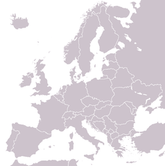
A blank political map of Europe extracted from Image:European Union member states by number of houses.png. +Hexagon1 (t) 04:47, 26 November 2006 (UTC)
Other versions: if you wish to use a map to show historical information before 2008, use Image:BlankEurope-BeforeKosovo.png
Lisens

|
Dü könst det datei kopiare, widjerdu of feranre efter a reegeln faan't GNU Free Documentation License, wersion 1.2 of leeder faan't Free Software Foundation; diar as niks ünferanerlik an nään tekst üüb a föör- of bääftsidj. Dü könst di lisens tekst efterlees bi GNU Free Documentation License. |
| Detdiar datei häält en lisens oner det Creative-Commons-lisens „Nööm nääm - Oner salew konditjuunen 3.0. Ei portiaret“. | ||
| ||
| Detdiar lisenstiaken kaam mä't GFDL lisens update. |
Datei wersioonen
Klike üüb en tidjponkt, am detdiar wersion uuntulukin.
| Dootem/Tidj | Föörskaubil | Miaten | Brüker | Komentaar | |
|---|---|---|---|---|---|
| aktuel | 15:31, 26. Sep. 2022 | | 1.236 × 1.245 (78 KB) | BlackShadowG | Reverted to version as of 14:55, 27 October 2008 (UTC) |
| 00:40, 24. Feb. 2009 |  | 1.236 × 1.245 (78 KB) | Avala | ||
| 16:55, 27. Okt. 2008 |  | 1.236 × 1.245 (78 KB) | Quilbert | Reverted to version as of 05:53, 5 April 2008 – there is already Image:BlankEurope-BeforeKosovo.png | |
| 20:13, 24. Okt. 2008 |  | 1.236 × 1.245 (78 KB) | Avala | ||
| 07:53, 5. Apr. 2008 |  | 1.236 × 1.245 (78 KB) | Hoshie | redid microstates, beefed up Spanish N. Africa, SBAs, and Gibraltar | |
| 20:42, 25. Feb. 2008 |  | 1.236 × 1.245 (78 KB) | Hoshie | fixed Gibraltar, Ceuta and Melilla, and the SBAs | |
| 04:39, 24. Feb. 2008 |  | 1.236 × 1.245 (78 KB) | Hoshie | Added Kosovo since it has been internationally recognized | |
| 00:40, 4. Jan. 2008 |  | 1.236 × 1.245 (78 KB) | Hoshie | Re-drew ESBA and WSBA with circles until I study the CIA maps, boundary between Gibraltar and Spain. | |
| 06:47, 26. Nof. 2006 |  | 1.236 × 1.245 (44 KB) | Happenstance | A blank map of Europe extracted from Image:European Union member states by number of houses.png. ~~~~ |
Hü det datei brükt woort
Nään artiikel brükt detheer datei
Globaal brük faan datein
Jodiar ööder Wikis brük detdiar datei:
- Brük üüb de.wiktionary.org
- Brük üüb hu.wikipedia.org
- Brük üüb incubator.wikimedia.org
- Brük üüb it.wiktionary.org
- Brük üüb sl.wiktionary.org
- Brük üüb uk.wikipedia.org