
Datei:Provinces of the Netherlands.png
Grate faan detdiar föörskaubil: 424 × 600 pixel. Ööder apliasangen: 170 × 240 pixel | 339 × 480 pixel | 842 × 1.191 pixel.
Originaal datei (842 × 1.191 pixels, dateigrate: 121 KB, MIME-typ: image/png)
Beskriiwang
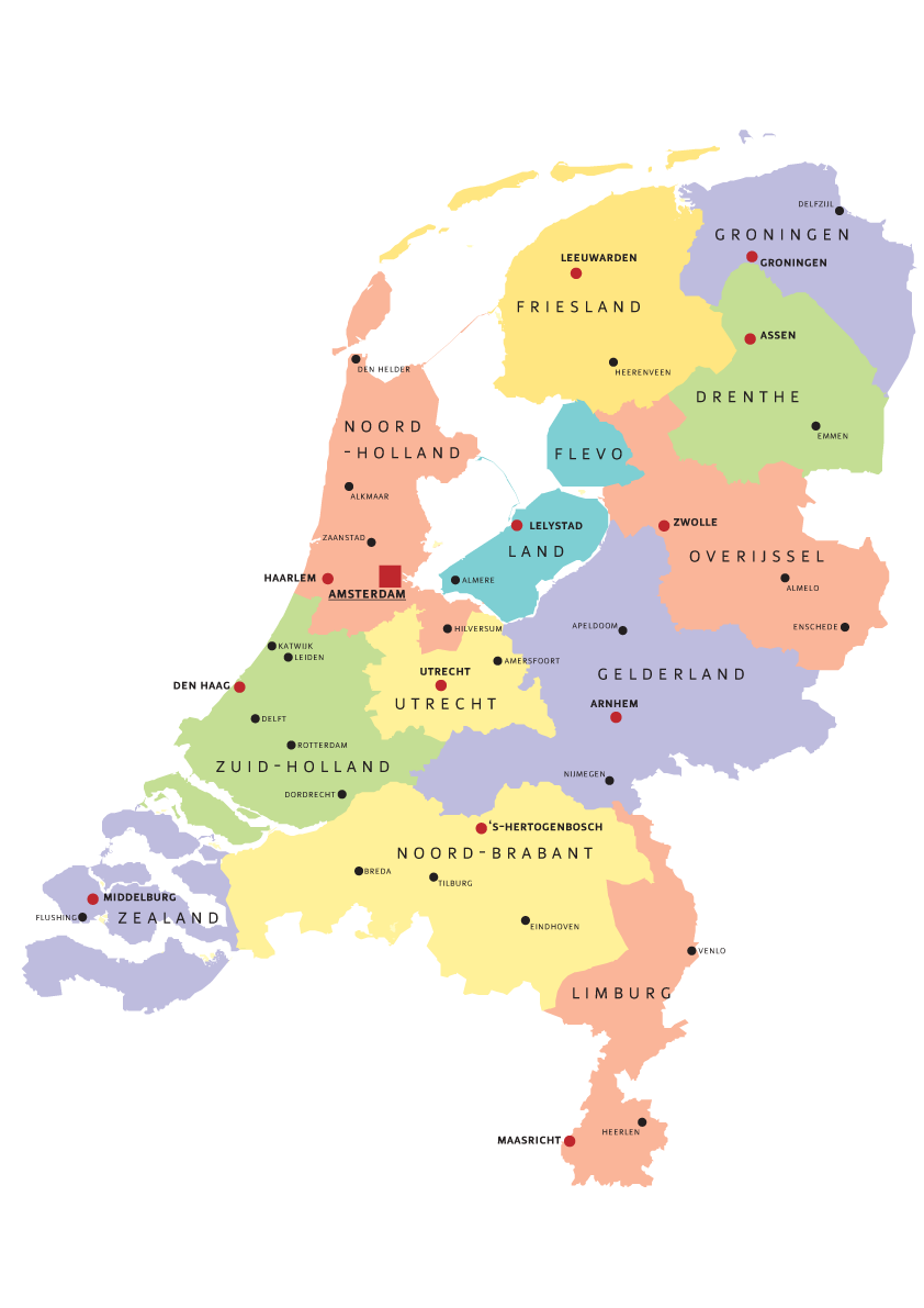
| Beskriiwang | Map of Provinces of Netherland |
| Dootem | |
| Kwel | Aanj werk |
| Skriiwer of Konstler | Norway.today |
Lisens
I, Norway.today häält a rochten üüb detdiar werk an dää det frei oner a lisensen:

|
Dü könst det datei kopiare, widjerdu of feranre efter a reegeln faan't GNU Free Documentation License, wersion 1.2 of leeder faan't Free Software Foundation; diar as niks ünferanerlik an nään tekst üüb a föör- of bääftsidj. Dü könst di lisens tekst efterlees bi GNU Free Documentation License. |
| Detdiar datei häält en lisens oner det Creative-Commons-lisens „Nööm nääm - Oner salew konditjuunen 3.0. Ei portiaret“. | ||
| nööm nääm: I, Norway.today | ||
| ||
| Detdiar lisenstiaken kaam mä't GFDL lisens update. |
Diese Datei ist unter den Creative-Commons-Lizenzen „Namensnennung – Weitergabe unter gleichen Bedingungen 2.5 generisch“, „2.0 generisch“ und „1.0 generisch“ lizenziert.
nööm nääm: I, Norway.today
- Dü mutst detdiar werk
- widjer du – detdiar werk kopiare an widjer du
- nei tuupstel – det werk feranre
- Oner jodiar konditjuunen:
- Nööm nääm – Dü skel di nööm faan di skriiwer of konstler nääm. Oober ei so, dat at so ütjsjocht, üs wan hi din werk gud fanjt.
- Oner josalew konditjuunen widjerdu – Wan dü detdiar werk feranerst, skel dü det resultaat oner detsalew lisens widjer du.
Schük di ian faan jodiar lisensen ütj.
Datei wersioonen
Klike üüb en tidjponkt, am detdiar wersion uuntulukin.
| Dootem/Tidj | Föörskaubil | Miaten | Brüker | Komentaar | |
|---|---|---|---|---|---|
| aktuel | 19:07, 5. Aug. 2007 | | 842 × 1.191 (121 KB) | Norway.today~commonswiki | == Summary == {{Information |Description= Map of Provinces of Netherland |Source=self-made |Date= 4. august 2007 |Author= Norway.today }} Category:Maps of the Netherlands |
| 16:30, 5. Aug. 2007 |  | 842 × 1.191 (120 KB) | Norway.today~commonswiki | {{Information |Description= Map of Provinces of Netherland |Source=self-made |Date= 4. august 2007 |Author= Norway.today }} Category:Maps of the Netherlands | |
| 16:25, 5. Aug. 2007 |  | 842 × 1.191 (127 KB) | Norway.today~commonswiki | {{Information |Description= Map of Provinces of Netherland |Source=self-made |Date= 4. august 2007 |Author= Norway.today }} Category:Maps of the Netherlands == Licensing == {{self|GFDL|cc-by-sa-2.5,2.0,1.0|author=I, [[User:Norwa | |
| 16:21, 5. Aug. 2007 |  | 842 × 1.191 (116 KB) | Norway.today~commonswiki | {{Information |Description= Map of Provinces of Netherland |Source=self-made |Date= 4. august 2007 |Author= Norway.today }} Category:Maps of the Netherlands |
Hü det datei brükt woort
Nään artiikel brükt detheer datei