Datei:Tresco Isles of Scilly UK parish locator map.png

Seiteninhalte werden in anderen Sprachen nicht unterstützt.
Faan Wikipedia

Originaal datei(3.000 × 3.000 pixels, dateigrate: 80 KB, MIME-typ: image/png)
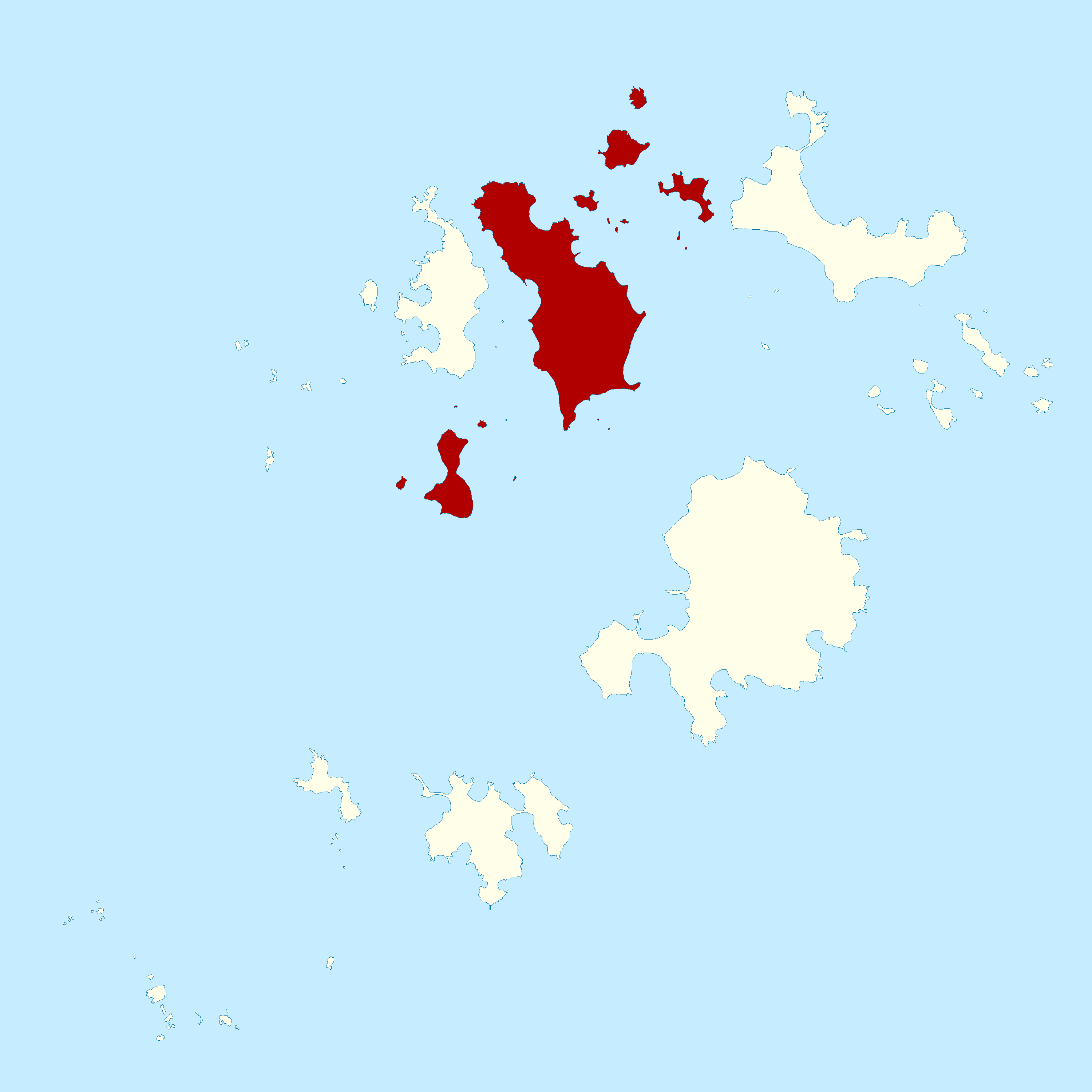
Detheer bil as faan Wikimedia Commons an koon faan ööder projekten brükt wurd. Det beskriiwang faan't beskriiwangssidj woort oner uunwiset.

Beskriiwang Tresco parish, in the Isles of Scilly off Cornwall, UK.
Dootem
Kwel Ordnance Survey OpenData, Boundary-Line product
Skriiwer of Konstler Ordnance Survey
Ferloof
(Hü det datei brükt woort)
This file is licensed by the Ordnance Survey of the United Kingdom under their OS OpenData License
In short: you are free to distribute and modify the file as long as you attribute (including year), the Ordnance Survey.
nööm nääm: Contains Ordnance Survey data © Crown copyright and database right (year)
Note: Derivative works can be licensed under any Creative Commons Attribution 3.0 Licence.
This file is licensed under the United Kingdom Open Government Licence v3.0.
You are free to:
  • copy, publish, distribute and transmit the Information;
  • adapt the Information;
  • exploit the Information commercially and non-commercially for example, by combining it with other Information, or by including it in your own product or application.
You must, where you do any of the above:
  • acknowledge the source of the Information in your product or application by including or linking to any attribution statement specified by the Information Provider(s) and, where possible, provide a link to this licence;
  • If the Information Provider does not provide a specific attribution statement, you must use the following:
Contains public sector information licensed under the Open Government Licence v3.0.
This licence does NOT cover:
  • personal data in the Information;
  • Information that has not been accessed by way of publication or disclosure under information access legislation (including the Freedom of Information Acts for the UK and Scotland) by or with the consent of the Information Provider;
  • departmental or public sector organisation logos, crests and the Royal Arms except where they form an integral part of a document or dataset;
  • military insignia;
  • third party rights the Information Provider is not authorised to license;
  • other intellectual property rights, including patents, trade marks, and design rights; and
  • identity documents such as the British Passport.
Consult this guide for full details.
Note: Since 2010, almost all information owned by the UK Crown is offered for use and re-use under the Open Government Licence by authority of The Controller of His Majesty's Stationery Office.info
See also: Meta for information on usage on Wikimedia wikis.

Kurzbeschreibungen

Ergänze eine einzeilige Erklärung, was diese Datei darstellt.

In dieser Datei abgebildete Objekte

motiif

Datei wersioonen

Klike üüb en tidjponkt, am detdiar wersion uuntulukin.

Dootem/TidjFöörskaubilMiatenBrükerKomentaar
aktuel00:02, 10. Jun. 2010Föörskau för det wersion faan 00:02, 10. Jun. 20103.000 × 3.000 (80 KB)Nilfanion{{Information |Description=Tresco parish, in the Isles of Scilly off Cornwall, UK. |Source=Ordnance Survey [https://www.ordnancesurvey.co.uk/opendatadownload/products.html OpenData], Boundary-Line product |Date=2010 |Author=Ordnance Survey |Permission={{O

Detdiar sidj brükt detdiar datei:

Globaal brük faan datein

Jodiar ööder Wikis brük detdiar datei: