South Dakota
Erscheinungsbild
| South Dakota | |
|---|---|
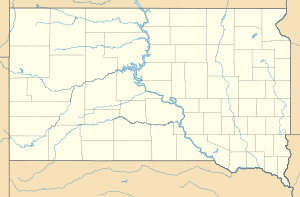
 (South Dakota foone) |
 (South Dakota säägel) |
| Uukelnoome: | The Mount Rushmore State |
| Oufkorting: | SD |

| |
| Hoodstää | |
| Grutste stää | |
| Guvernöör | |
| Gebiit - totool |
Nr. 17 199.731 km² |
| Beföljking - totool |
Nr. 46 781.919 (2006) |
| Beföljkingstachthäid - totool |
3,9 inb./km² |
| Tuträäs önj e union - nr. |
40 |
| Tidssoone | Central: UTC -6/-5 Mountain: UTC -7/-6 |
| Briidjgrood | 42°29'30"N bit 45°56'N |
| Laingdegrood | 98°28'33"W bit 104°3'W |
| Briidj Laingde |
340 km 610 km |
South Dakota as en diiljstoot foon da Feriind Stoote. E diiljstoot läit önj't norden foon't lönj. Dåt heet 884.659 manschne (2019)[1]. E hoodstää foon e diiljstoot as Pierre.
Geografii
[Bewerke | Kweltekst bewerke]E diiljstoot läit önj e Great Plains. Önj't weesten lade e Black Hills.
Stääse
[Bewerke | Kweltekst bewerke]Da tiin grutst stääse önj e diiljstoot san:
| # | Stää | Manschne (2019)[2] | Koord | |
|---|---|---|---|---|
| 1 | Aberdeen | 28.257 | ||
| 2 | Box Elder | 10.119 | ||
| 3 | Brandon | 10.074 | ||
| 4 | Brookings | 24.415 | ||
| 5 | Huron | 13.380 | ||
| 6 | Madison | 7270 | ||
| 7 | Mitchell | 15.679 | ||
| 8 | Pierre | 13.867 | ||
| 9 | Rapid City | 77.503 | ||
| 10 | Rapid Valley | 9000 |
Counties
[Bewerke | Kweltekst bewerke]South Dakota heet 66 counties:
Kiik uk deer: List foon counties önj South Dakota
Kwäle
[Bewerke | Kweltekst bewerke]44.483333333333-100.25
Koordinaaten: 44° N, 100° W


